Wednesday, August 12, 2020

Useful maps in Sahyadris Revised


Coming with new maps useful for treks in Sahyadris

 Earlier in 2012, I wrote a blog post about maps in Sahyadris http://ontheedgeofsahyadris.blogspot.com/2012/02/useful-maps-for-treks.html

These were hand drawn maps(that time, Google maps were not much popular) 

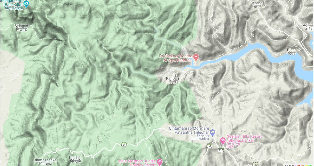
Now, to that I am posting images with areas identified in google maps and waypoints taken on garmin gps device so that the nearby base villages also can be identified on maps.

From Salher in North till Chorla Ghat these maps are arranged from North starting point of Sahyadris till South part of Sahyadris till Goa , Maharashtra and Karnataka border


Nasik Region


Salher- Mulher And Mangi Tungi: The starting point of Sahyadri

Salher(1567 meters is the highest fort in Maharashtra)


Saputara in Dang district and Surgana Peth region of Nasik district.


Saptashringi Area


   Trimbakeshwar-Igapturi Area


   Patta Vishramgad

Kalsubai peak : Highest in Maharashtra Sahyadris(1646 meters)


Bhandardara Region


Kalsubai-Harishchandragad Sanctuary


Junnar-Malshej Region


 Karjat Murbad Bhimashankar Region


    Siddhagad Gorakhgad

Bhimashankar and Ahupe region


   Pune - Maval and Lonavala Area


Mulshi Dam Tamhini area


Raigad Fort


Velhe Torana-Rajgad  region


   Bhor - Wai Area

Raireshwar, Durgadi, Kangori forts and Varandha ghat: 
Nira Devghar Dam Varandha ghat area, this region is accessible by mototable roads between Bhor and Mahad. Raireshwar is a flat plateau of around 13 kms and has around 40 to 50 houses on top.


Mahabaleshwar Area
Forts like Pratapgad, Makarandgad,Kamalgad, Chandragad, 
Base villages are accessible by motorable roads from Wai and Mahabaleshwar


Amboli- South Konkan Area

Amboli Ghat: This is accesible by motorable road from Kolhapur-Ajra and from Sawantwadi


Tilari : This Area is accessible from Dodamarg-Sawantwadi in Maharashtra, Belgaum-Khanapur in Karnataka and from Bicholim , Mapusa, Assnora in Goa by direct motorable road. 

Chorla Ghat : This area is approachable from Belgaum and Sattari Area of Goa. Chorla ghat is a motorable road between Belgaum and Goa.


Thursday, May 21, 2015

Durgadi Janani Durg fort parallel to Varandha ghat

Durgadi Janani Durg fort parallel to Varandha ghat

Durgadi fort or Janani Durg(Now Named as Mohangad) was found out by a team of archeologists from Deccan college Pune in year 2010-11
It is located parallel to Varandha ghat and Raireshwar and Kolheshwar mountains near Mahabaleshwar
It is located in very dense forests of Javali which are similar to the forests in the koyna region.Around 15 to 20 years back, tigers were seen in this region
About the history of fort
It is believed that this fort should be more than 400  to 1000 years old since it has water tanks and caves  on top of it.During the period of Chatrapati Shivaji Maharaj, this region was lead by Baji Prabhu and the construction of forts in this region was in progress(Durgadi, Kawalya ,Kangori forts) but unfortunately while fighting a battle at Pawankhind, Baji Prabhu lost his life and the building forts in this region didn’t continued hence in this region, you will find that almost all forts were in half stage of construction
It is believed that Durgadi fort was used as a watch tower to keep watch on routes in konkan like  Varandha and Kamtha ghat(Kamtha ghat route is not used anymore because this route is damaged in landslide after koyna earthquake around 1957)
How to approach Durgadi fort
From Pune/Bhor take a bus to Mahad(Going through Varandha ghat) and ask for Shirgaon stop(Tell the conductor that you want to go to Durgadi and before shirgaon, there is a left turn where you have to get down)
You will be able to see backwaters of Neera Devghar dam while travelling through varandha ghat route to mahad. Look for the milestone showing Mahad 36 kms
From this place, the road starts climbing uphill and now you will not be able to see the backwaters of the dam.2 kms before Shirgaon, you will see a board pointing towards left  “Janani Devi Mandir”.From this place, leave the Bhor-Mahad road and take the road going to left.
After 1 km walking, you will reach the Janani devi temple
In front this temple, there is a route going In dense forests, climb through this route.In 15 to 20 minutes, you will reach a halfway mark.From here, there are 2 routes.One route goes left and other route goes towards right side.
Follow the route towards right.From here, you will reach the top in around 45 minutes
Don’t go to the left side route because you will go deep in the forest and end with a blocked route in dense forests.We went by this route first but in 15 minutes, we found that this route is going downwards whereas we were supposed to climb the mountain but still we hoped that somewhere, we will get a route to climb up but we didn’t get it. Instead we were landed in a place where the route was blocked by big fallen trees and there was a small water pool in forest with pugmarks of wild pigs
From this place, we came back to the place where there are 2 routes and followed the route towards right and reached the top
There is nothing to be getting lost.Follow the route in forest.There is only one route which goes to the top through a narrow ridge.There is valley on both sides of ridge with dense bushes and trees coming in way.

Be careful at the top near the temple especially when you are climbing down from this point.If you slip here, you will land into the valley.There is no excuse for that

It was 3:00 pm hence we returned back fast till 4:00 pm to Durgadi village and later to Shirgaon, got bus  and came to bhor around 6:00 pm
About Bus timing: From Bhor , there are buses to Durgadi approx every 2 hours and last bus is around 6:00 pm whereas there are frequent buses from Pune to Mahad going by this route.Ask for buses going by Varandha ghat only to Mahad. From Pune, there are 2 routes to Mahad(Varandha ghat and Tamhini ghat)

Also this fort can be approached from Kiye/Gothali/Pimpalwadi village(base village of Kangori Mangalgad fort) after descending Varandha ghat, from varandh village,take left to go to these villages(Buses available from Mahad)
Here are the pictures
Janani Durg seen from Shirgaon village near Varandha ghat

View of Varandha ghat and Neera Devghar Dam from Durgadi

Dense Javali forests towards Raireshwar and Aswal Khind


Kangori Mangalgad fort seen while climbing Durgadi fort

Varandha ghat region and the forests seen below in the valley

View of Varandha ghat from Durgadi fort


Durga Temple on top of Janani fort

Be careful while climbing down from here.If you slip, there is no excuse